|
|||||||||||||||||||||||||||||||||
 |
|||||||||||||||||||||||||||||||||
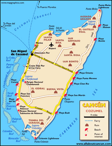
| Cozumel is 33 miles long and 11 miles wide. It is the largest island in the Republic of Mexico. Twelve miles to the west is the mainland of Mexico, separated by a channel that is 3,000 feet deep. | |||||||||||||||||||||||||||||||||
The island of Cozumel was settled by the Mayas as early as 300 AD. It became an important seaport for Mayan trade because it was well positioned in the middle of routes to and from Honduras and Vera cruz. In addition, Cozumel history began as a pilgrimage site; the shrines of Ixchel, goddess of fertility, drew worshippers from all over the Mayan empire. The site of this worshiping was what is now the San Gervasio ruins, located on the transversal road going east on the island. Cortéz and his men destroyed many of the Mayan temples on Cozumel; after he departed the island to further explore the peninsula, a smallpox epidemic broke out and Cozumel's population fell to less than 300 people by 1570. By the year 1600, Cozumel was completely abandoned. In the 17th century, pirates took advantage of Cozumel's isolation and used it as a base for operations. The most notable of Cozumel's pirates was American pirate Jean Lafitte. The island was not re-inhabited until 1848, when settlers from the mainland sought refuge there from the Caste War, a fierce war that broke out when the Mayas decided to avenge the wrongs inflicted on them and their lands by the Spanish. Cozumel remained a quiet little fishing community until 1961, when French explorer Jacques Cousteau proclaimed the area's waters one of the most spectacular scuba diving sites in the world. The island became a divers' haven and eventually, a cruise ship port-of-call. Today, Cozumel has evolved into a tourist destination popular even with people who don't scuba dive. |
|||||||||||||||||||||||||||||||||
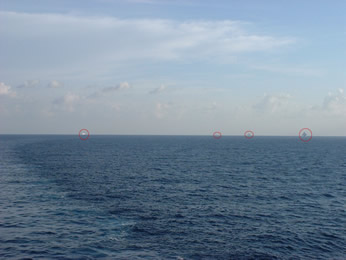 |
Cozumel has a population of about 80,000. On the day we arrived, several other cruise ships did also, and we were told there were 20,000 tourists being put ashore. LEFT- 4 cruise ships are approaching. RIGHT-Our ship is the one on the left. |
 |
|||||||||||||||||||||||||||||||
| We had decided that instead of taking a guided tour here (most of which took you to the mainland) we would rent a car and drive the one highway that goes part way around the island. That way we could stop anywhere along the beach we wanted to and could see the Mayan ruins at San Gervasio which aren't too extensive to begin with. Besides, we're scheduled for a tour of the Mayan ruins in Belize. | |||||||||||||||||||||||||||||||||
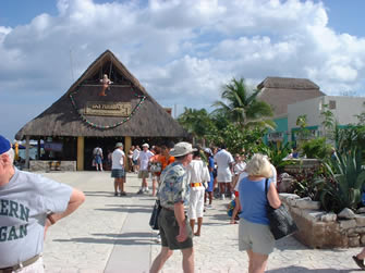 |
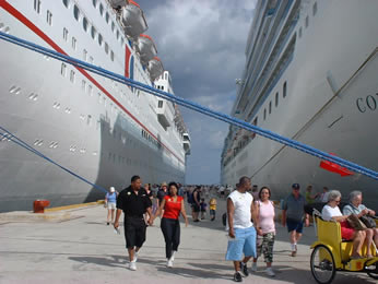
The area at the docks is very colorful and definitely aimed at the tourists. | 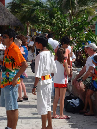 |
|||||||||||||||||||||||||||||||
 |
But we headed straight for our piece-of-crap Volkswagen and hit the open road along with the other piece-of-crap Volkswagens. Ours had no shocks, springs or mirrors and the seat belts didn't work. Top speed appeared to be about 45 mph. It was fun and reminded us of the old days-when we couldn't afford anything more than this. | ||||||||||||||||||||||||||||||||
 |
|||||||||||||||||||||||||||||||||
 |
|||||||||||||||||||||||||||||||||
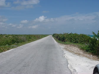
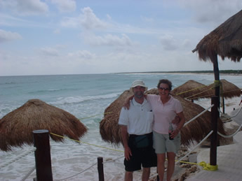
| As we drove around the island we were amazed that there were almost no towns or buildings and the beaches were empty. It seems that nearly all of the 80,000 inhabitants live on one side of the island. So we stopped for lunch at one of the bars you do find along the beach. |  |
||||||||||||||||||||||||||||||||
 |
|||||||||||||||||||||||||||||||||
 |
|||||||||||||||||||||||||||||||||
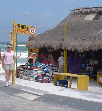
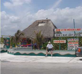
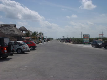
Then we found K-Mart and Target. Great sense of humor these folks have. This area is right where the beach road takes a 90 degree turn to the West and becomes the Cross-Island Road. BELOW-This is the view down the Beach road. Other than 4 buildings at this corner, there is nothing in sight. |
 |
||||||||||||||||||||||||||||||||
 |
|||||||||||||||||||||||||||||||||
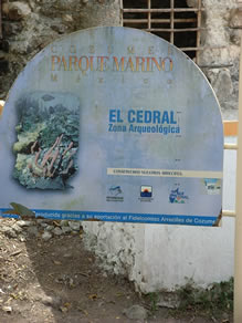 |
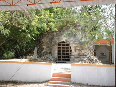
We also found our way to the Mayan ruins at El Cedral. The main claim to fame for this site, according to one of the locals, is that there was a fertility celebration here each year. In fact, that's the fertility god on the right. He also said that there are still festivals held here each year in the Spring. This site is also unique in that it is the only one in Central America where there is Mayan temple and a church right next to each other, as shown below. | 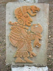 |
|||||||||||||||||||||||||||||||
 |
|||||||||||||||||||||||||||||||||
 |
|||||||||||||||||||||||||||||||||
 |
 |
||||||||||||||||||||||||||||||||
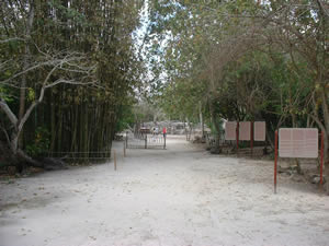
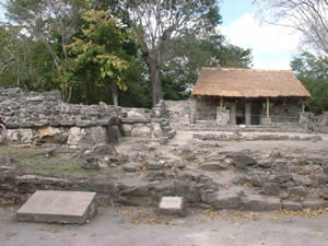
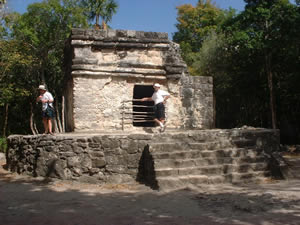
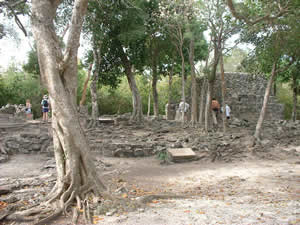
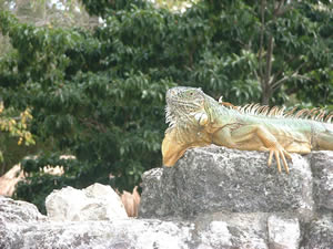
| Above center is the entrance to the ruins of San Gervasio, which dates back to 300-400 AD. San Gervasio controlled the smaller settlements on the island. Not sure what the one on the left was. But the one on the right is a temple that was visible when entering or leaving the site.It was originally stuccoed and decorated with red, ochre and blue colors. An altar was in the center of the building. Lower left photo is of the Murcielagos, which is where the overlord lived during the 600-1000 AD period. Lower right photo is a large iguana. But he's green, so he's edible. | |||||||||||||||||||||||||||||||||
 |
 |
||||||||||||||||||||||||||||||||